
Home
The Future of Stillwater viewed thru the lens of the past.
FREE Apps 〰️
FREE Apps 〰️
All of the Images Below Are Links to Seven Different FREE APPS. These APPS will work for any computer or mobile smart device. They will work from your armchair anywhere. The best experience is when you are in Stillwater, nearby these historic locations. Your smart device then will know where you are and every time you enter a new historic location, it will provide photos, text or audio information related to the location. Just click on the TOUR of your choice and learn about the early days of Stillwater, Minnesota

Main Street Tour
App for All Mobile Devices
This features 15 active sites and triggers a visual cue when a new geo fence is entered.

Downtown Guided Tour
App for All Mobile Devices.
This features a quick guided tour of downtown Stillwater MN. It triggers a visual cue when a new geo fence is entered.

Main Street Tour
App is ONLY for APPLE iOS Devices.
It features 19 active sites and triggers an audio as well as a visual cue when a new geo fence is entered
Downtown Guided Tour
App is ONLY for Android Devices.
It features 19 active sites and triggers an audio as well as a visual cue when a new geo fence is entered.
This APP can be used on any mobile device.
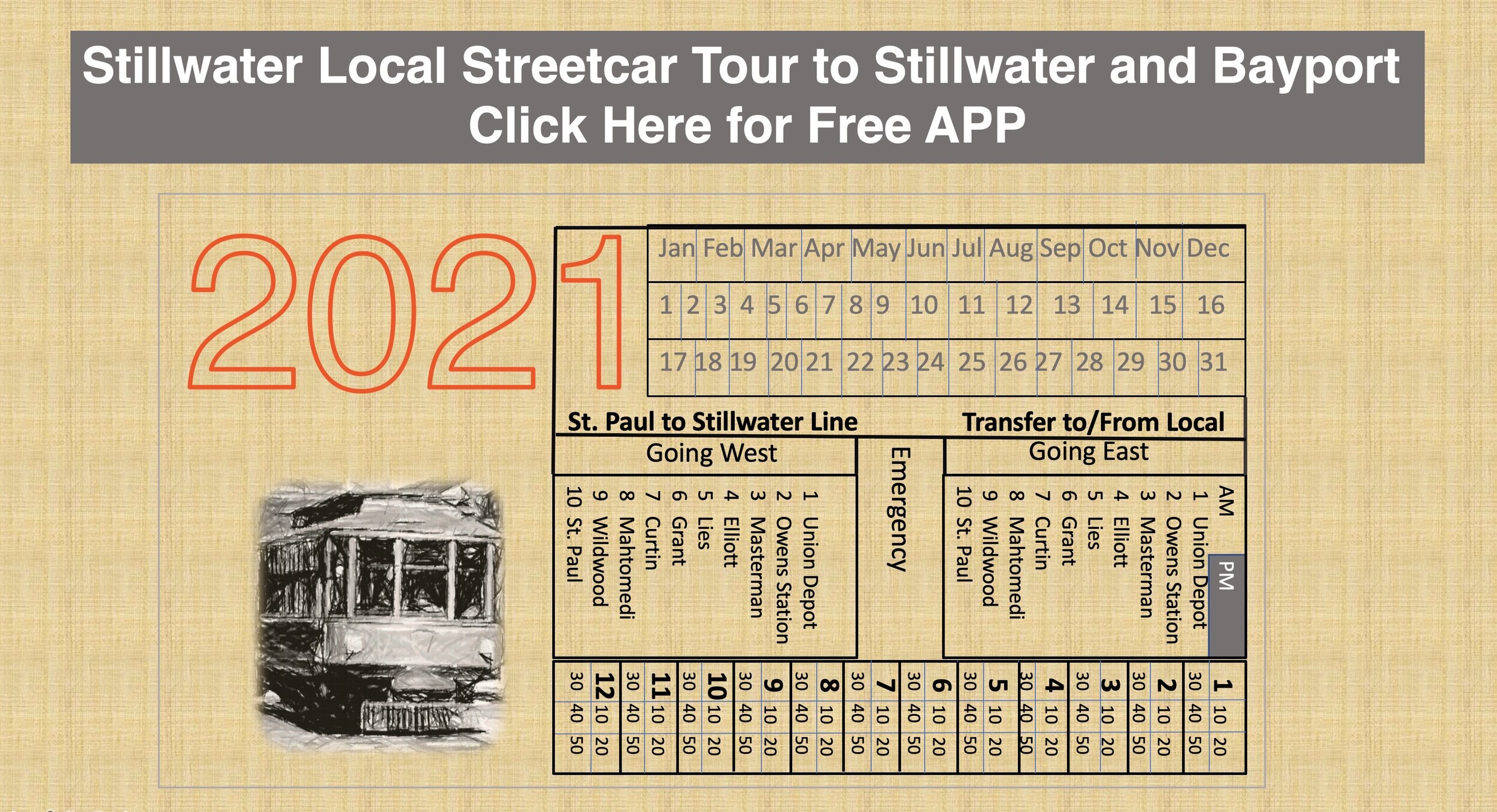
Take a tour of Stillwater as it was when it was serviced by the early Streetcars. Use the map of the Stillwater Streetcars that ran between Stillwater and Bayport. There are stories about the streetcars, the fares and the people who used them. Walk, pedal or ride as a passenger in a car and enjoy what it was like in the early 1900’s to ride on a streetcar. This APP can provide a Virtual Reality Tour from your armchair anywhere in the world. The APP works best when you are actually in the city of Stillwater when you use your mobile device to sense your location and provide photos, text and sounds of the Stillwater Streetcars of what that same location was like in the early days of the streetcars.
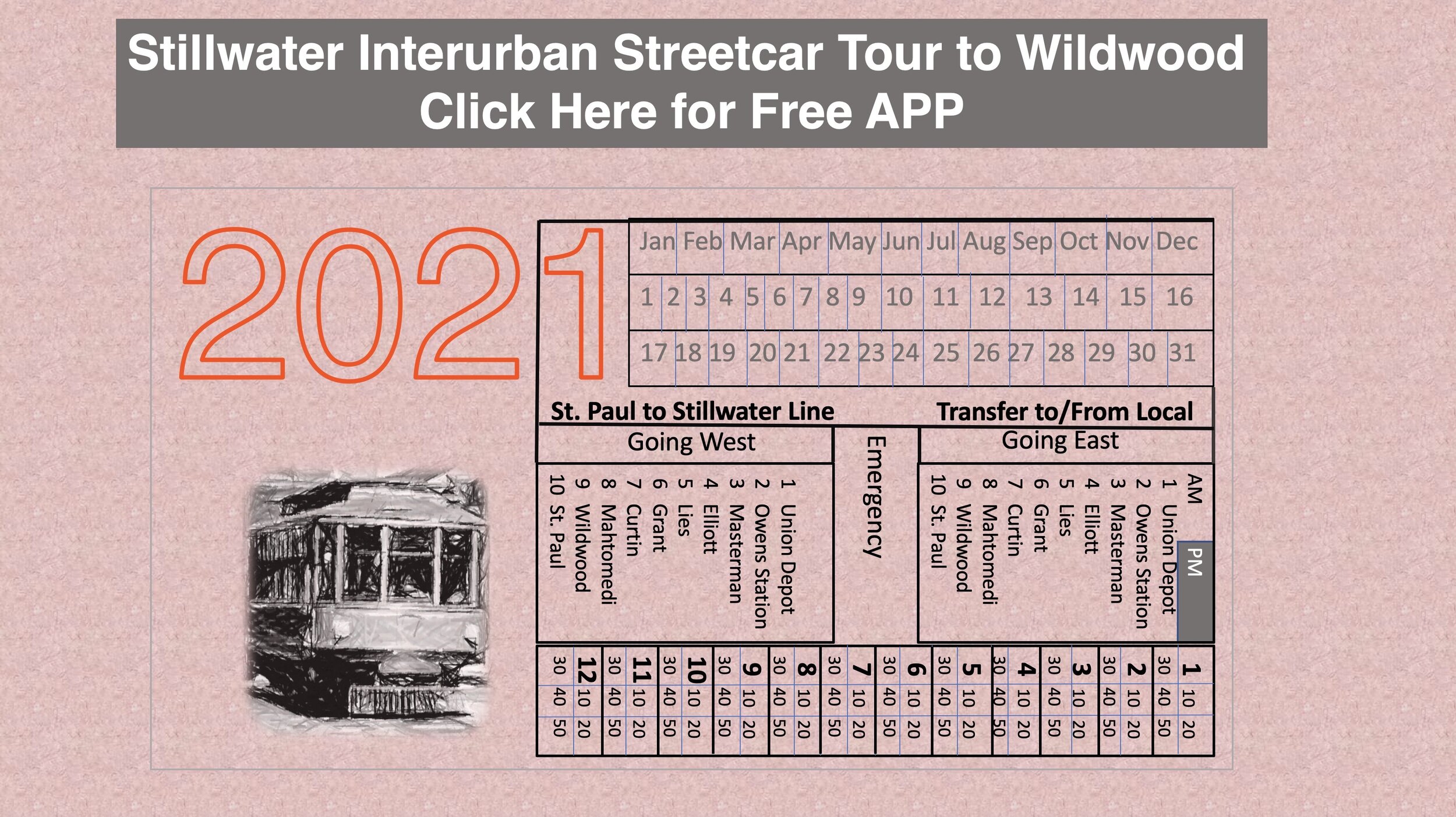
Stillwater Interurban Streetcar to Wildwood
This APP can be used on any mobile device.
Take a tour of the places where the Stillwater Interurban Streetcar crossed as it came and went to Wildwood Amusement Park. View the path of the early tracks and hear about Elliott Crossing and the family that lived along the streetcar tracks. Listen to and read about the “News Flashes” sourced from the newspapers that described the progress and problems of building the streetcar line in 1899. Learn about how these powerful Interurban Streetcars crossed busy railroad tracks between Stillwater and Mahtomedi. This APP can provide a “Virtual Reality” tour from your armchair anywhere in the world. The APP provides the best experience when you are nearby any of these locations. Your mobile device knows your location and when it senses your nearness to any of the historic locations, it provides you with historical images, text and audio that are relevant to that location.

FREE APP History on The Loop Trail
This APP can be used on any mobile device. Enjoy and Learn about the History of Locations near the St.Croix Crossing Loop Trail. Figure out how many sawmills were here and explore the difference between Mr. Hersey and Mr. Hershey. The APP provides a good map and a “Virtual Reality Tour” of these important locations along the trail in Wisconsin and Minnesota. The best Experience is to be nearby any of these locations and have your mobile device sense your location. Your mobile device will then tell you about what it was like in the early years at the same location. It will show you historical photographs, text and audio about the nearby historical or fun location.

Free APP Fire Run Tour of Stillwater
This APP can be used on any mobile device. Have you ever wanted to be a Firefighter? The Year 2022 is the 150th Anniversary of the Stillwater Fire Department. This tour takes you to all of the Fire Stations in Stillwater and some historic fires that were part of the historic past of Stillwater, Minnesota. There are sounds of the past that will let you know when you have arrived at one of the active locations. There are linked videos and stories of how important horses were to the early firefighters.
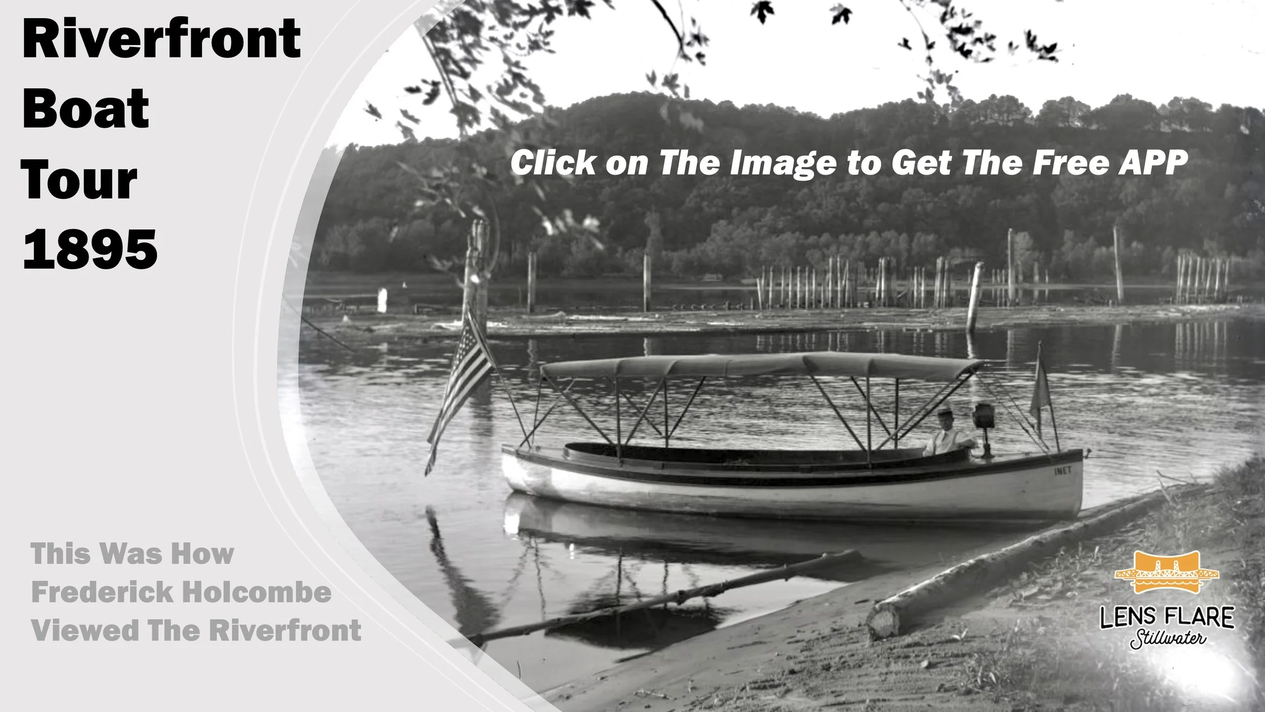
Click on the Image above to Go to The Stillwater Riverfront Boat Tour. This tour features the photographs of Frederick Holcombe taken in the time period of 1895-1900. The photos were taken with glass plate negatives that gave the images high resolution so that you can see the background of his original images in considerable detail. The Tour path is taken from a boat path up the center of the St. Croix River. The tour shows what the riverfront looked like in 1895-1900 as seen from the lens of Frederick Holcomb’s camera. The tour takes you from the south of Stillwater to the Stillwater Boom Site.
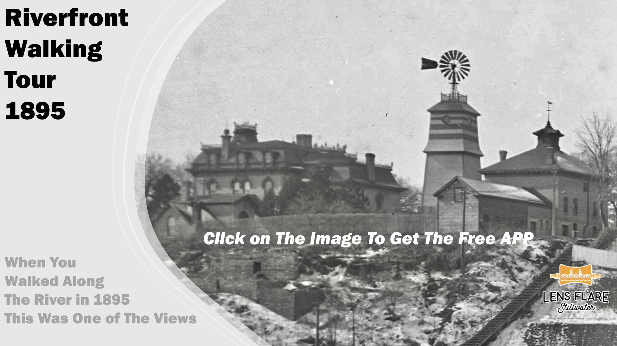
Click on the image above to go to the Stillwater Land-based Tour of the Riverfront. This tour features the photographs of Frederick Holcombe, who was a photographer in 1895-1900. His photo was taken on a coated Glass Plate that provided a high resolution image. This allowed the background in his photograph to provide another story about the riverfront of Stillwater at that time. The tour will take you from the south of Stillwater (Oak Park Heights) to the St. Croix Boomsite and some of the scenes you might have seen along the way. It represents some of the very few images we have of the Stillwater waterfront at that time.